


CAIRS 9-1-1
Built on standards-based interfaces for interoperability across NG9-1-1 environments

CAIRS 9-1-1 delivers standards-based location management, emergency call routing, and real-time incident notification for enterprise, government, service-provider, and emergency communications environments. Integrated with voice platforms, network infrastructure, and authoritative GIS data, CAIRS keeps dispatchable location information current, validates emergency locations, and helps route calls to the appropriate public safety answering point.
From automated endpoint discovery and location synchronization to NG9-1-1 routing, legacy E9-1-1 support, and onsite notifications, CAIRS provides the tools organizations need to manage emergency communications from a single integrated platform—deployed on premises, in the cloud, or across hybrid environments.
Compliant with Title 47 1.A.9 (Kari’s Law, Ray Baum’s Act), NENA i3 NG 9-1-1 and Legacy E9-1-1
Location Information Server
Automated VoIP Discovery
Centralized management for device and user location information
The CAIRS Location Information Server (LIS) determines and delivers accurate location information for connected devices and communications endpoints. Through the standards-based HTTP-Enabled Location Delivery (HELD) interface, devices and authorized applications can request civic or geodetic location by value or reference. Integration with voice platforms, network infrastructure, and discovery services helps keep dispatchable location information current and available throughout the emergency communications workflow.
CAIRS 9-1-1 Modules
Location Validation Function
The CAIRS Location Validation Function (LVF) verifies civic and geodetic locations against authoritative GIS data before they are used for emergency call routing. Through the standards-based Location-to-Service Translation (LoST) interface, applications and network elements can submit locations for validation and receive detailed results identifying valid, invalid, incomplete, or ambiguous addresses. This helps maintain accurate dispatchable location records and improves the reliability of NG9-1-1 call routing.
Additional Data Repository
The CAIRS Additional Data Repository (ADR) securely stores and delivers supplemental emergency information associated with callers, devices, locations, and organizations. Using standards-based NG9-1-1 interfaces and data formats, authorized systems can retrieve information such as building details, floor plans, access instructions, hazards, emergency contacts, and other operational data. This additional context gives telecommunicators and responders greater situational awareness and supports a faster, safer, and more informed response.
Spatial Interface
The CAIRS Spatial Interface (SI) connects authoritative GIS data with NG9-1-1 functional elements such as the Location Validation Function and Emergency Call Routing Function. It imports, synchronizes, and manages geospatial layers—including road centerlines, address points, service boundaries, and emergency service zones—using standards-based data structures and interfaces. By keeping routing and validation data current, the SI helps ensure locations are accurately validated and emergency calls are directed to the appropriate public safety answering point.
Manage the geospatial foundation of NG9-1-1 directly within CAIRS. Native feature-layer capabilities allow organizations to create, import, edit, visualize, and maintain address points, road centerlines, service boundaries, building data, and other authoritative GIS layers without relying on a separate management interface. Integrated spatial validation helps detect gaps, overlaps, and geometry issues before they affect location validation or emergency call routing.

Emergency Call Routing Function
The CAIRS Emergency Call Routing Function (ECRF) uses authoritative geospatial data and policy-based routing rules to determine the appropriate destination for an emergency request. Through the standards-based Location-to-Service Translation (LoST) interface, NG9-1-1 call-routing elements can submit civic or geodetic location information and receive the URI of the responsible PSAP or emergency service. Integrated with the CAIRS LVF, Spatial Interface, and geospatial feature layers, the ECRF helps ensure emergency calls are routed accurately, consistently, and in accordance with current service boundaries.
Emergency Service Routing Proxy
The CAIRS Emergency Services Routing Proxy (ESRP) provides policy-based routing and secure signaling control for NG9-1-1 emergency calls. It evaluates call information, location, service state, and configured routing policies to select the appropriate ECRF, PSAP, or alternate destination while supporting redundancy, failover, and continuity of service. Through standards-based SIP, PIDF-LO, and LoST interfaces, the ESRP interoperates with NG9-1-1 core services and connected emergency communications networks to help ensure each call reaches the correct destination with its location and associated data intact.
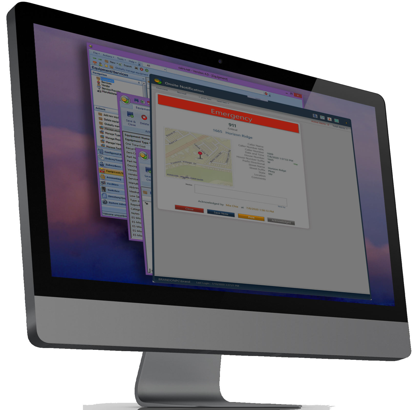
CAIRS Emergency Alert Client
The CAIRS Emergency Alert Client provides immediate onsite awareness when an emergency call is placed. Desktop pop-up alerts, audible alarms, map-based incident details, and acknowledgement workflows notify designated personnel such as security teams, front desk staff, facilities personnel, school administrators, and emergency coordinators who may be able to assist before public safety arrives.
Integrated with CAIRS emergency event monitoring, the client can display caller, building, floor, room, and location context in real time while maintaining event history and acknowledgement records for escalation and after-action review. It operates in parallel with the PSAP call path and can be supplemented by email, SMS, Microsoft Teams notifications, and automated phone calls.

Discovery Assistant
The CAIRS Discovery Assistant Client helps maintain accurate emergency location information for teleworkers and mobile employees operating beyond the enterprise network. When a user connects from a remote location, the client can automatically identify available network and location data, update the user’s emergency calling context, and help ensure calls are associated with the correct dispatchable location.
When automated discovery is unavailable or cannot determine a reliable location, users can securely self-report and validate their current address through a guided interface. This combination of automated discovery and user-assisted location reporting helps organizations support remote workers while maintaining accurate, current location records for emergency communications.
Enhanced 9-1-1
Management Solutions for Legacy E9-1-1 Environments
ALIson
The CAIRS ALIson service automates the transfer of Automatic Location Identification (ALI) records from CAIRS to the PSAP’s legacy E9-1-1 ALI database. It formats, validates, and transmits subscriber, telephone number, and dispatchable location information using supported NENA 2 and NENA 3 data-exchange formats, reducing manual data entry and helping keep PSAP records accurate and current.
By monitoring changes within CAIRS and processing additions, updates, and removals through a controlled workflow, ALIson improves data consistency, provides transfer status and error reporting, and supports reliable emergency location delivery in legacy E9-1-1 environments.